
Upcoming drone survey in Ahipara
Ahipara Takiwā and the council will conduct a drone survey of coastal erosion around the Kaka Street beach access and surrounding areas in Ahipara over coming weeks.
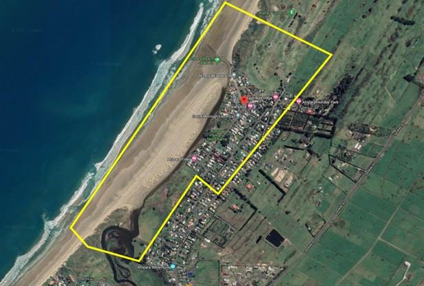
Ahipara Takiwā and the council will conduct a drone survey of coastal erosion around the Kaka Street beach access and surrounding areas in Ahipara over coming weeks.
The survey will provide detailed information on coastal erosion processes around the access point to the beach and along the shoreline. It will also help to define stormwater drainage areas on the land.
The survey will take about two days and involves flying an unmanned, automated drone across the area at a height of approximately 100m. Information obtained by the drone will be used to map ground contours in high definition.
Drone flights are dependent on settled weather and will also be timed to coincide with tides. That means an exact start date is not available, but the survey should be completed this month.
Leaflets were delivered on Monday 26 September by the Ahipara Takiwā to residents that may be affected.
If you require any further information, you can contact council on 09 401 5200 or 0800 920 029.
Tags: News story