
Online map details council slip repairs
A new online mapping tool developed by Northland’s three district councils shows the latest repair plans for the 195 remaining slips (85 in the Far North) still affecting district roads in the wake of severe weather events that hit the region in 2022-23.
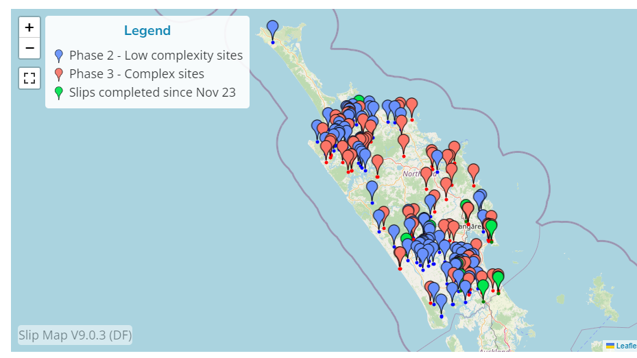
A new online mapping tool developed by Northland’s three district councils shows the latest repair plans for the 195 remaining slips (85 in the Far North) still affecting district roads in the wake of severe weather events that hit the region in 2022-23.
The Northland slip repair map uses a ‘pin’ to show the exact location of each remaining slip affecting the council-maintained roading network that resulted from the 2022/23 weather events. Clicking on the pin reveals details including the type of slip, its size, what repairs are required, and whether repairs are in the planning, investigation, design or construction stage. A completion estimate is also included. The pins are colour-coded to differentiate between slips requiring complex and longer-term repairs, and those less complex sites. It also shows completed slip repairs.
The online tool was published on the Far North District Council website on Monday 25 March, and on the Kaipara and Whangarei district council websites soon after.
Far North Kahika Moko Tepania says the Northland local road network suffered approximately $89 million worth of damage from at least 10 different significant weather events since July 2022. An estimated $41 million of this damage occurred in Far North District, with approximately $15m of these repairs completed to date.
“We have restored most roads but are still working on 85 sites in the Far North. To some motorists, it may seem like very little is happening to address these remaining slips. That is not the case. Some of these sites are very complex with significant engineering, planning and funding questions that must be resolved before contractors can start working on repairs. The reality is that it will take another year or more to start some repairs.”
He says the Northland slip repair map provides motorists with at-a-glance plans for repairs to routes they regularly travel on, and for all other district roads impacted by slips in Northland.
The Northland slip repair map was created in-house by the three councils and uses data provided by the Northland Transportation Alliance (NTA) on roads maintained by the three councils.
The NTA is a collaboration between Northland councils and Waka Kotahi NZ Transport Agency to deliver joined up services for roading and transportation in Northland. Information on slips affecting the state highway network can be found on the Waka Kotahi NZ Transport Agency website.
Go to the Northland slip repair map here.
Tags: News story