Satellite imagery reveals Far North development

Planners, community groups, landowners and developers now have a fresh perspective with the latest update of KompSat imagery, a satellite which observes the earth’s environmental, infrastructure, and agricultural changes.
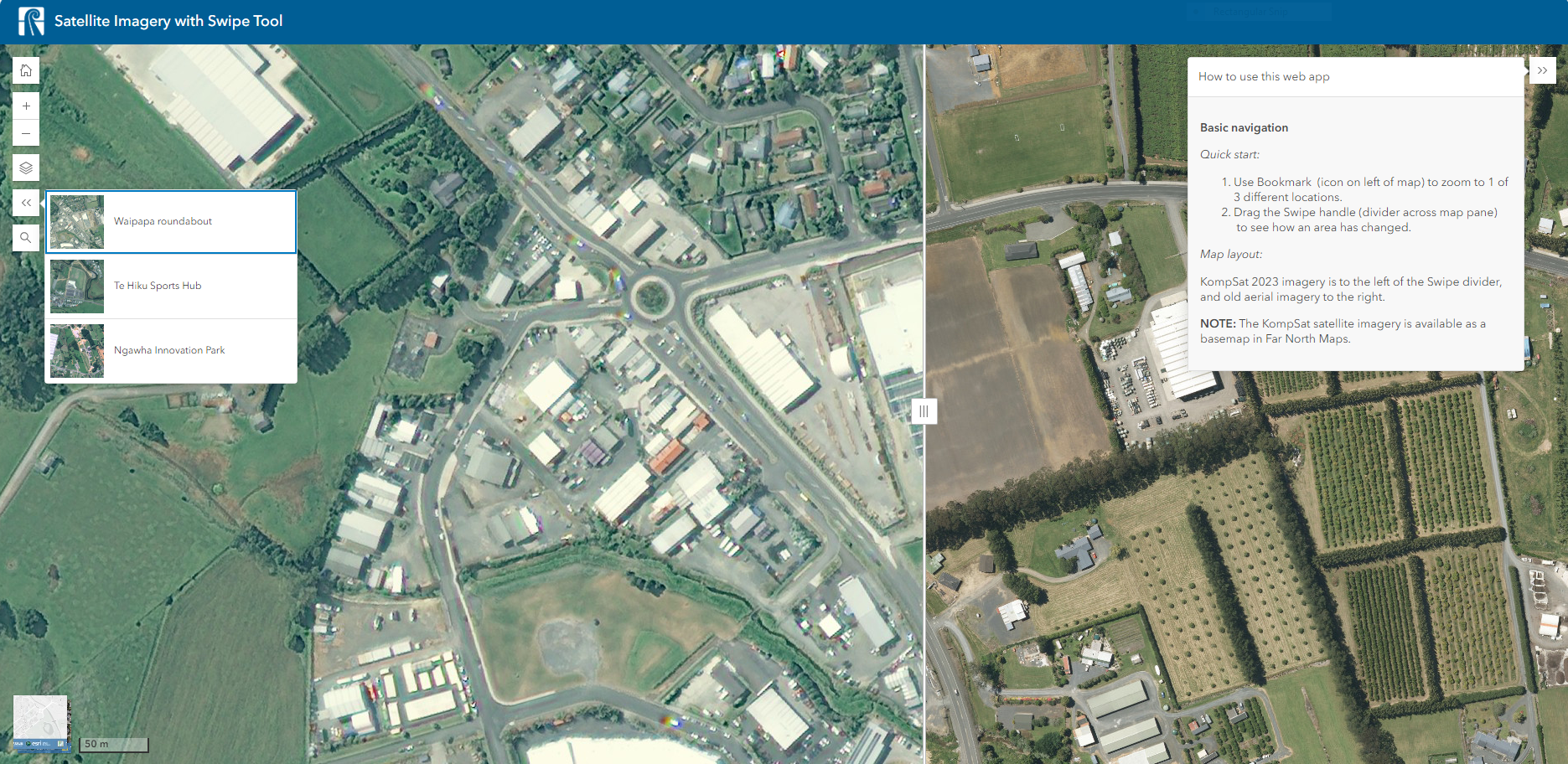
The new satellite imagery map includes a swipe tool that lets you compare the latest view of the region to older aerial images, allowing users to see how an area has changed over time. For example, by using the slider, users can see how Waipapa has changed as the Waipapa roundabout and new retail areas have been added. This function allows for seamless visual comparison between current satellite images and aerial photos. You can view the map here.
The new tool will allow community groups, planners and developers, and anyone interested in the Far North’s development to see how the landscape has changed as new infrastructure is added and other features have changed. Current planning is that satellite imagery will be updated annually for the next three years to ensure maps remain up-to-date.
The KompSat satellite imagery is available as a basemap in all Far North Maps. Far North Maps are the council’s public geographic information system (GIS). It is an interactive mapping tool that holds spatial information such as property boundaries, zones, services, and hazards as separate layers.
You can find all Far North Maps here.
If you have any questions, please contact our helpdesk at ask.us@fndc.govt.nz.
Tags: News story

