
Swim safely in the Far North
Northland’s exceptional beaches are popular with locals and visitors for swimming, surfing, kayaking, paddle boarding and fishing.
However, the surf here is powerful and can result in the slope of the seabed changing underfoot over time. Rips and undertows do occur and drownings are possible.
To protect yourself and your whānau please consider the precautions outlined below.
- Check surf lifesaving organisations for updates about specific beaches.
- Take note of any safety signage and the hazards identified.
- Be realistic about your own capabilities in the water.
Beach hazards
Many of our beaches do not have surf lifesaving patrols operating. Some beaches are equipped with floatation devices. If you notice a floatation device is missing or damaged, then please let us know.
Cable Bay
Cable Bay, at the southern end of Doubtless Bay, is a north facing bay about a kilometre in length. It is a relatively steep, sandy beach which is 5 to 15 metres wide, above the high tide line.
Be aware that the beach structure and shape here is highly dynamic. Watch out for hazards like rip currents, which can change over time. Please keep children within arm's length at all times.
Known hazards include:
- deep shelving is a natural physical feature of the beach
- exposed rocks at low tide
- possible rip currents at creek mouth after large rain events
- strong winds are possible
- rock outcrops at each end of the beach with tidal rock pools.
Little Cable Bay
Little Cable Bay is just along from the main bay and shares many similar features. Watch out for hazards like rip currents, which can change over time. Please keep children within arm's length at all times.
Known hazards include:
- deep shelving is a natural physical feature of the beach
- exposed rocks at low tide
- possible rip currents at creek mouth after large rain events
- strong winds are possible
- rock outcrops at each end of the beach with tidal rock pools.
Taipā Beach
Taipā Beach in Doubtless Bay, is a north east facing beach over a kilometre long. Taipā Beach is a barrier spit attached to Otanguru Point at the western end. The beach width is less than 5 metres above the high tide line. The Taipā River entrance is at the eastern end. Please be aware this is a boating area and keep children within arm's length at all times.
Known hazards include:
- exposed rocks at low tide
- estuarine current, which increases on an outgoing tide
- strong winds are possible
- rock outcrops at each end of the beach with tidal rock pools.
Coopers Beach
Coopers Beach in Doubtless Bay, is a north facing bay. The beach is backed by cliffs and situated between Te Homamu Point in the west and Rangikapiti Point in the east. Both the Kanenane and Otanenui Stream mouths are near the western end of the beach. Please be aware this is a boating area and keep children within arm's length at all times.
Known hazards include:
- exposed rocks at low tide
- possible rip currents at creek mouth after large rain events
- strong winds are possible
- rock outcrops at each end of the beach with tidal rock pools.
Water safety information
For more information about our Doubtless Bay beaches go to - Safeswim.
You can also learn how to stay safe at the beach, how to spot hazards and what to do when you encounter one, at the links below.
Our water safety signage
The Council has installed bilingual water safety signs at Cable Bay, Coopers Beach and Taipā. The signs are as close as possible to existing surf life saving equipment or on the main approaches to beaches.
We are working with Surf Lifesaving New Zealand to identify other beaches where water safety signage is needed.
These signs meet the requirements of the Australian/New Zealand Standard, AS/NZS 2416 Water safety signs and Beach safety flags standards.
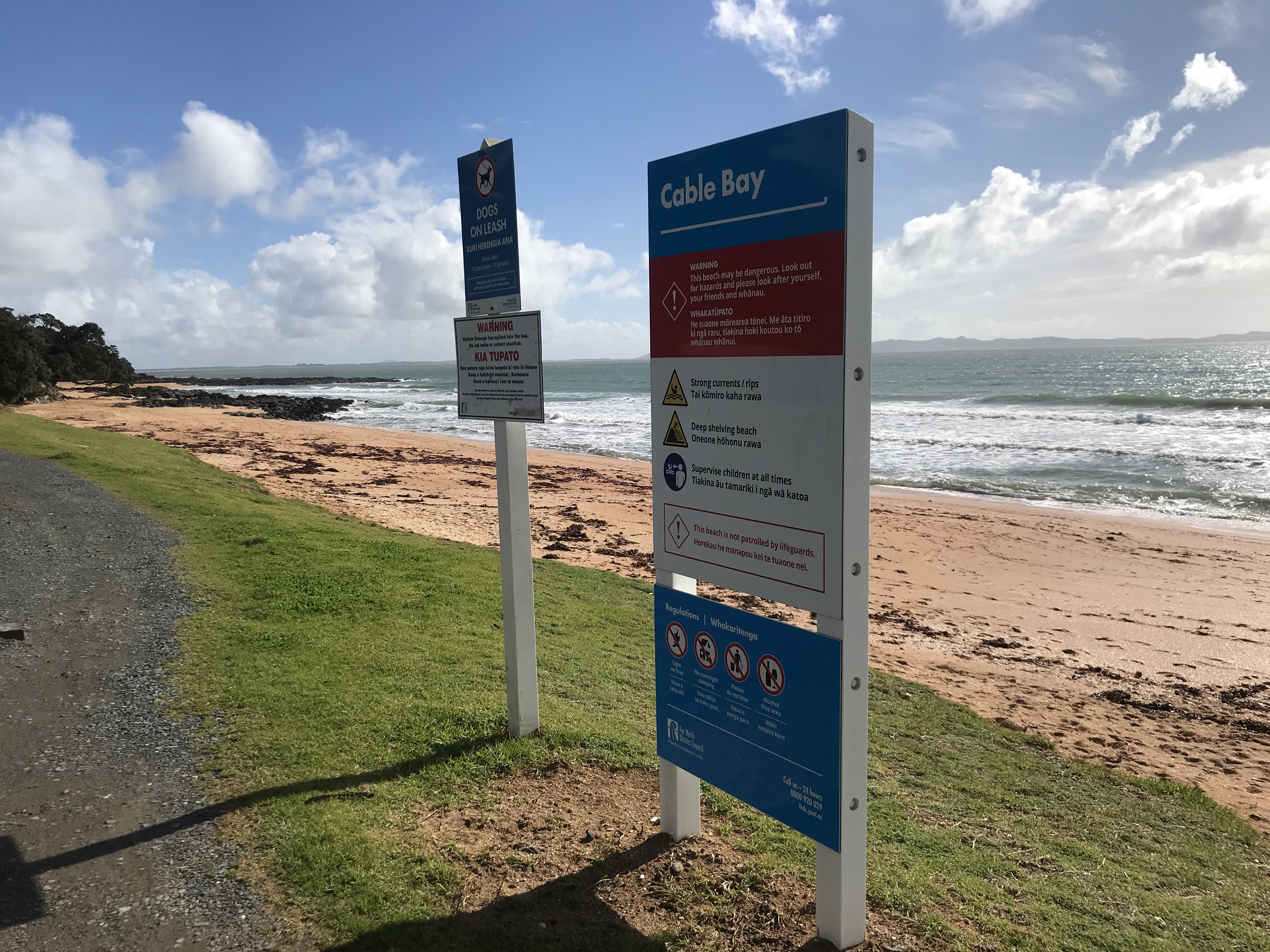
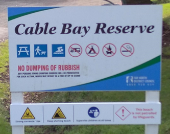
We have also attached warning symbols to existing reserve signage as an extra precaution.
Can I swim here?
Visit Land, Air, Water Aotearoa (LAWA) for the latest water quality information. You can select a site to see the water quality test history, what facilities are available, and there's helpful information on recreational monitoring in New Zealand.
Recreational water quality monitoring runs from November / December through to March for most regions on this site.
Water sampling regime
The Far North District Council works with Northland Regional Council to administer the Ministry for the Environment’s Microbiological Water Quality Guidelines for Marine and Freshwater Recreational Areas (environment.govt.nz).
This is done by testing water samples from coastal and fresh water locations across the district.
Health warning signs
Where contamination is found, we erect health hazard warning signs to advise the public against swimming, bathing and collection of shellfish. The signs remain in place until water sample readings have dropped to an acceptable level.
These signs are uniformly used throughout Northland, which includes the Whangārei and Kaipara District Councils.
You can find out about current warnings on Northland Regional Council's website.