
New online mapping tool estimates development contributions
Thinking of building? You can now use an online map to quickly confirm whether your property is in a development contributions catchment area and get an indicative cost of the amount that may be due.
The Utu Whakawhanake - Development Contributions Policy was adopted by the council last year and is due to be applied from 1 July and charges developments that create additional demand for infrastructure. The contributions help fund new or expanded infrastructure such as transport routes, water supply, wastewater, stormwater drainage, and community facilities required to service growth. The contributions help to ensure that the costs of growth are shared by those creating the demand, rather than falling on ratepayers.
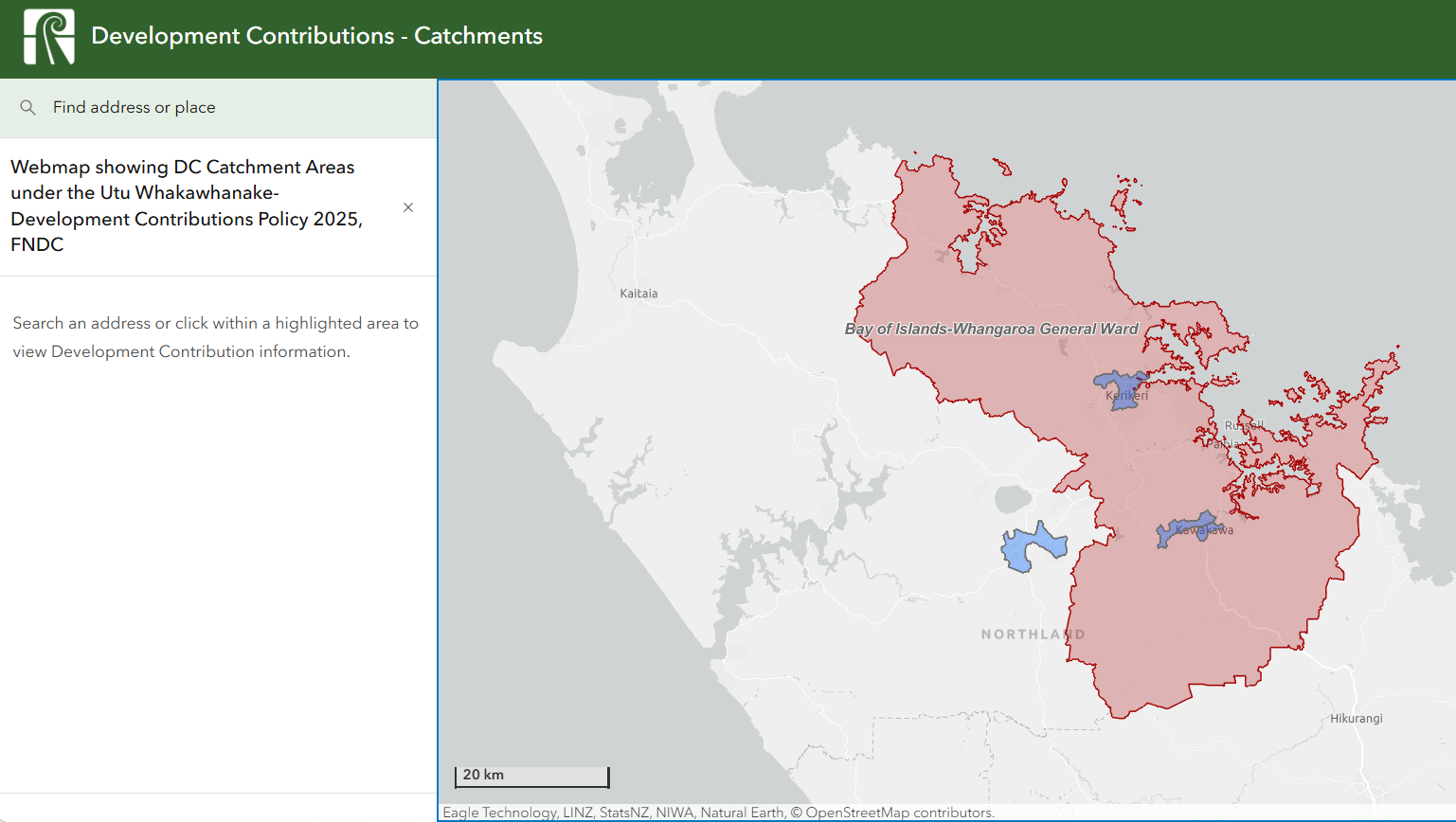
Currently, development contributions are being applied to the high growth areas of Bay of Islands-Whangaroa Ward, Kerikeri, Kawakawa/Moerewa and Kaikohe. Contributions collected within a specific catchment must be spent on capital projects that support growth within that area.
Anyone thinking of building can use the mapping tool to confirm whether development contributions will be applied on their property and get an estimate of the fees likely to be levied. The fees shown are for a single property in a standard residential development, commercial developers requiring detailed assessments should contact the council directly to request a pre-assessment.
The mapping system can be accessed from computers, tablets and mobile devices, and will evolve as more data, policy updates, and functionality are added to improve usability and public access to information.
You can view the map here.
Last updated: 05 Jun 2026 3:08pm
ℹ️ You can also subscribe to our monthly newsletter to receive a summary of the latest news and updates from the district, delivered directly to your inbox. Sign up here.