
Aerial survey of Aupōuri aquifer begins next week
An aerial survey of Te Hiku begins next week, part of a study of the Aupōuri aquifer that aims to increase understanding of the precious water source and help ensure it is used sustainably.
An aerial survey of Te Hiku begins next week, part of a study of the Aupōuri aquifer that aims to increase understanding of the precious water source and help ensure it is used sustainably.
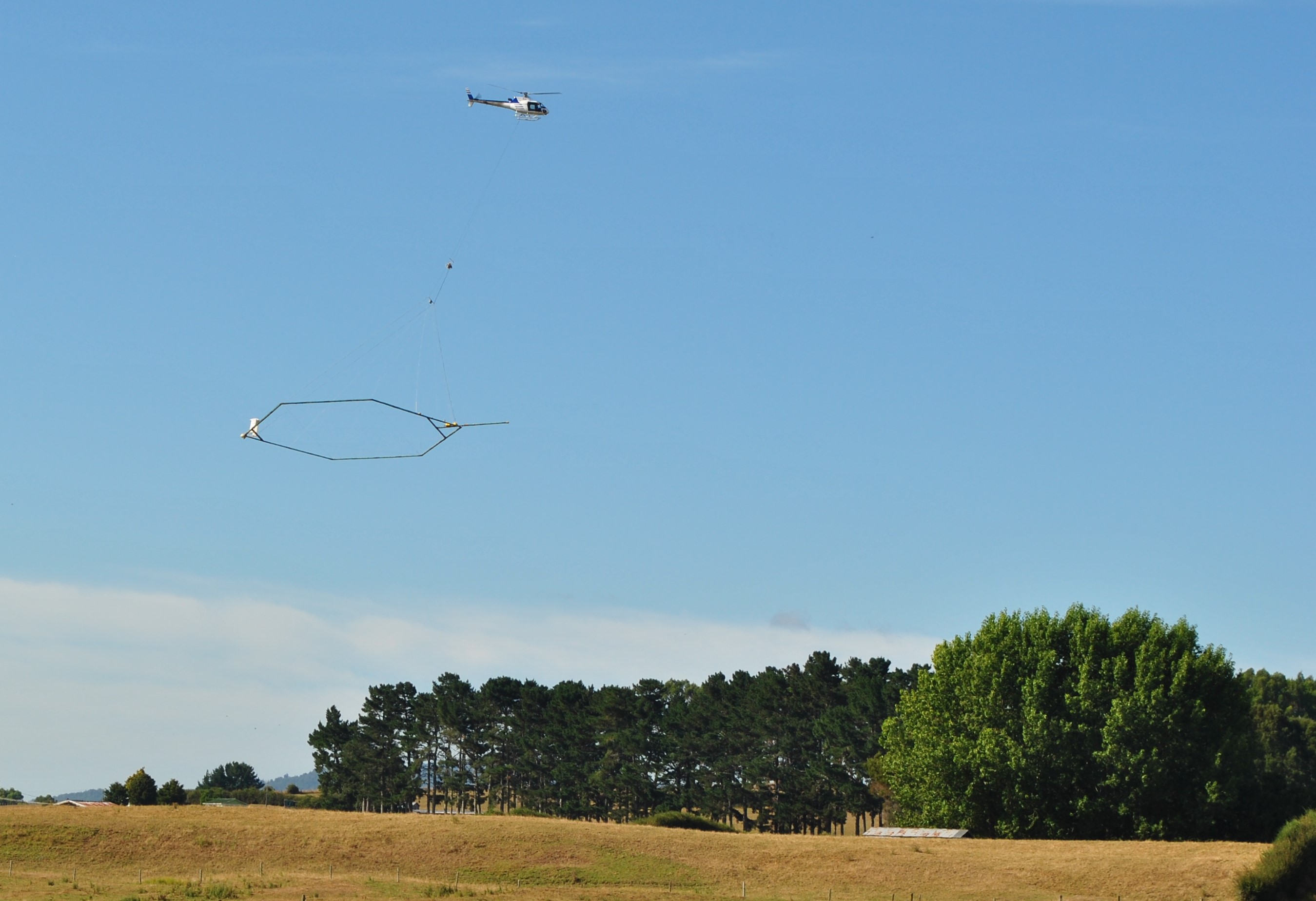
Aerial electromagnetic (AEM) surveying will be conducted from Ahipara to Cape Rēinga and is a key part of the community initiated Te Hiku Water Study. The survey will begin mid-next week (depending upon the weather) and will take up to two months to complete.
AEM involves flying in parallel lines about 100m above the land with a loop system suspended beneath a helicopter. Transmitters on the loop send electromagnetic signals underground, and sensors measure the behaviour of the returning signals. Similar to radar, the method allows scientists to ‘see’ what’s under the ground by looking at and interpreting the way the signals return. The survey will not gather images or information on anything above the ground.
AEM is a safe and effective measurement tool used around the world and was most recently deployed in New Zealand at Hawke’s Bay in 2020.
The Te Hiku Water Study project team represents iwi, the community, landowners and councils. The project is using a combination of aerial surveying and drilling of groundwater bores to build a better picture of the Aupōuri aquifer. The goal is to help identify the best ways of balancing environmental protection with increased water demand for drinking and agriculture, as well as coping with drought events.
The survey is predominantly funded by Aqua Intel Aotearoa (AIA), which is a collaboration between Kānoa (the delivery arm of the Provincial Growth Fund) and GNS Science. Funding is also provided by Northland Regional Council, Far North District Council, Ngai Takoto, and Te Aupōuri. Surveying will be undertaken by specialists from SkyTEM Australia. GNS scientists will interpret and analyse the raw data and provide the resulting information, subject to agreed guidelines, in formats useful for councils, mana whenua and the community.
Helicopter flights will be subject to suitable weather conditions. Go to the Aqua Intel website to find out where flights will be conducted each day.
Northland-based project team members are Wallace Rivers (Ngai Takoto), Craig Wells (Ngai Takoto), Walter Wells (Ngati Kuri), Penetaui Kleskovich (Te Aupōuri), Stewart Otene (Te Rarawa), Wendy Thomas (landowner), Ian Broadhurst (landowner), Eric Wagener (Ratepayers Association), Susie Osbaldiston (Northland Regional Council) and Roger Ackers (Far North District Council). The project team includes Jane Frances and Ben Pasco from Aqua Intel Aotearoa, and Chris Worts from GNS Science.
Last updated: 04 Apr 2024 12:55pm
ℹ️ You can also subscribe to our monthly newsletter to receive a summary of the latest news and updates from the district, delivered directly to your inbox. Sign up here.